
Forest and Related Ecosystems
Sri Lanka has a striking variety of forest types brought about by spatial variations in rainfall, altitude, and soil. The forests have been categorized broadly as tropical wet lowland evergreen forests (at elevations between 0-1000 m); wet sub-montane forests (at elevations between 1000-1500 m in the wet zone); wet montane forests (at elevations of 1500-2500m); tropical dry mixed evergreen forests in the dry lowlands, with riverine vegetation along river banks; tropical moist evergreen forest in the intermediate zone; thorny scrub in the arid areas; and mangrove swamps in the coastal areas, fringing the lagoons and at the river mouths. In addition, different types of grasslands occur in the wet and dry areas, in the lowlands as well as in the hills. As the wet lowland forests transform into sub-montane and montane forests, there is a progressive decline in canopy height, and at the highest elevations above 2000 m, unique pygmy forests may occur. The most extensive forest type, the tropical dry mixed evergreen forest, is characterized by a canopy that is relatively open and seldom exceeds 20 meters in height.
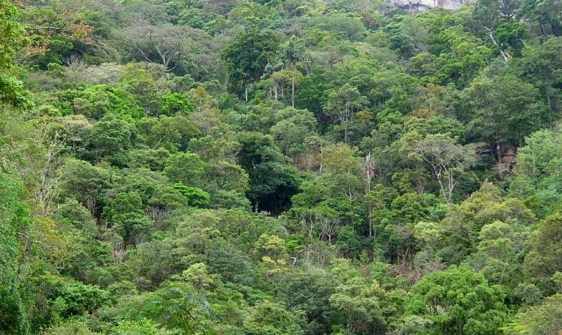
Knuckles Forest
Forest Types Found Within the Island of Sri Lanka
| Forest Classification | Characteristics (Annual Avg.) | Approximate Extent (Sq. km) On Island | Districts Containing Forest Type * |
|---|---|---|---|
| Montane Forest | Above 1500 m elevation Temperatures ~ 15 ° C Rainfall > 1800 mm with no moisture deficit period | 31 | Nuwera Eliya, Kandy, Badulla, Matale, Ratnapura |
| Sub-Montane Forest | Within elevations of 1000 m to 1500 Temperatures 15 ° – 20 ° C Rainfall > 1800 mm | 690 | Nuwera Eliya, Ratnapura, Kandy, Matale, Badulla, Kegalle, Matara, Anuradhapura, Monaragala |
| Lowland Rain Forest | Extending from the Coastal plains to 1000 m Temperatures > 20 ° C Rainfall > 2500 mm no moisture deficit period Vegetation –visible lichen and liana species | 1415 | Ratnapura, Kalutara, Galle, Matara, Kandy, Matale, Kegalle, Nuwera Eliya, Colombo, Badulla, Monaragala, Gampaha |
| Moist Monsoon Forest | Found at < 1000 m Rainfall 1800 – 2500 mm with a peak from October – January with a dry period of 3 months following. | 2439 | Monaragala, Polonnaruwa, Ampara, Matale, Badulla, Batticaloa, Ratnapura, Kandy, Nuwera Eliya, Matara, Kurunagala, Hambantota, Gampaha, Trincomalee |
| Dry Monsoon Forest | Has a distinct season: a rainfall peak from mid-October to January (coinciding with monsoon rains) and a dry period for 3-6 months. Vegetation is semi-diciduouse. At elevations of < 600 m often on slopes. Rainfall 1000 – 1800 mm |
10940 | Anuradhapura, Mullaitivu, Monaragala, Mannar, Trincomalee, Vavuniya, Puttalam, Ampara, Polonnaruwa, Killinochchi, Battocaloa, Hambantota, Matale, Kurunagala, Ratnapura, Badulla, Jaffna, Matara |
| Riverine Dry Forest | Found along flood plains and river valleys. < 600 m Rainfall 1000 – 1800 mm | 224 | Ampara, Monaragala, Hambantota, Trincomalee, Puttalam, Mannar, Polonnaruwa |
| Mangrove Forest | Present along intertidal sheltered coastlines, usually associated with river mouths and lagoons. Vegetation usually consists of Rhizophora species | 87 | Puttalam, Trincomalee, Batticaloa, Mannar, Hambantota, Mullaitivu, Killinochchi, Ampara, Jaffna, Galle, Gampaha, Kalutara, Matara |
Forest and related ecosystems in Sri Lanka
| Ecosystem Type | Extend (ha) |
|---|---|
| Tropical wet lowland evergreen forest (includes lowland and mid elevation rain forests) | 123302 |
| Tropical sub-montane forest | 28513 |
| Tropical montane forest | 44758 |
| Tropical moist monsoon forest | 117885 |
| Tropical dry monsoon (mixed evergreen) forest | 1121392 |
| Tropical thorn forest | NA |
| Riverine dry forest | 2425 |
| Grasslands (wet pathana, dry pathana, savannah, etc) | 68043 (savannah only) |
Natural Forest Cover by District in Sri Lanka -1999
| DISTRICT | Land Area (ha) | Montane Forest | Sub Montane Forest | Lowland Rain Forest | Moist Monsoon Forest | Dry Monsoon Forest | Riverine Dry Forest | Mangrove | Sparse Forest | Total |
|---|---|---|---|---|---|---|---|---|---|---|
| Totals (ha) | 6616627 | 3099.5 | 65792.3 | 124340.8 | 221977 | 1027544.1 | 22412 | 9530.5 | 471583.2 | 1942219.5 |
| Ampara | 450031 | 45519.2 | 67197 | 10148 | 299 | 40966.2 | 164129.4 | |||
| Anuradhapura | 722178 | 164794.6 | 82.4 | 99525.5 | 264402.5 | |||||
| Badulla | 285673 | 94.5 | 3030.3 | 1610.6 | 15750.8 | 2266.8 | 26645.8 | 49398.8 | ||
| Batticaloa | 263983 | 13378.2 | 19733.8 | 1855 | 17766.3 | 52733.3 | ||||
| Colombo | 68469 | 1359.7 | 487.8 | 1847.5 | ||||||
| Galle | 161256 | 18849.4 | 104.3 | 1584.6 | 20538.3 | |||||
| Gampaha | 141890 | 240.8 | 121.5 | 362.3 | ||||||
| Hambantota | 262307 | 207 | 570.3 | 18218.7 | 3709.9 | 492 | 59630.2 | 82828.1 | ||
| Jaffna | 107848 | 794.3 | 242.8 | 317.6 | 1354.7 | |||||
| Kalutara | 164391 | 14021.2 | 4575 | 18596.2 | ||||||
| Kandy | 192808 | 935.1 | 8633.3 | 14065.6 | 3543.9 | 7146.2 | 34324 | |||
| Kegalle | 168328 | 3705.4 | 9985.1 | 44.2 | 1096.4 | 14831.1 | ||||
| Kilinochchi | 132499 | 32149.2 | 424 | 5026.6 | 37599.8 | |||||
| Kurunegala | 489787 | 1260.9 | 6264.6 | 11973.1 | 19498.6 | |||||
| Mannar | 200148 | 104888 | 568.6 | 1486.2 | 16797.3 | 123740.1 | ||||
| Matale | 206050 | 89 | 4780.4 | 8217 | 31108.7 | 12330.5 | 13461.4 | 69987 | ||
| Matara | 130829 | 536.2 | 15717.6 | 1772 | 441.3 | 1.4 | 1773.8 | 20242.3 | ||
| Moneragala | 576763 | 11.2 | 392.5 | 56769 | 104089.7 | 1366.5 | 57579.8 | 220208.7 | ||
| Millaittivu | 260946 | 148745.5 | 405.2 | 20152.8 | 169303.5 | |||||
| Nuwara Eliya | 174109 | 1940.1 | 29384.1 | 3639.3 | 121.4 | 4620 | 39704.9 | |||
| Polonnaruwa | 344988 | 46388 | 67430 | 523.6 | 21333.7 | 135675.3 | ||||
| Puttalam | 315485 | 66615.1 | 129.4 | 2337.5 | 17545.6 | 86627.6 | ||||
| Ratnapura | 327034 | 40.8 | 15711.4 | 36035.1 | 5746.4 | 1393.1 | 11562 | 70488.8 | ||
| Trincomalee | 267991 | 4 | 108710 | 1823.7 | 1761.6 | 14446.7 | 126746 | |||
| Vavuniya | 200836 | 101481.9 | 15568.8 | 117050.7 |
