Environmental conflict mapping through GIS and historical event data collection and analysis
Location: The Northern province - Jaffna, Mannar, Vavuniya, Kilinochchi, and Mullaitivu Districts
Eastern Province - Ampara, Batticaloa, and Trincomalee Districts
Duration: February – September 2022
Project Background:
The Northern and Eastern Provinces of Sri Lanka present a highly complex ethnic and religious composition and have been the heart of the protracted civil war. In a post-conflict context, the region has witnessed polarization of communities over access to, ownership of natural resources, such as land and water. The drivers of resources-based conflicts can be attributed to institutional, economic, social and climate constraints. However, local grievances caused by constraints have the propensity to take an ethicized direction in a politically and socially fragile post-conflict environment. The overlap between natural resource boundaries and administrative boundaries, siloed approaches to the resolution of disputes on resource-access and resource-sharing between ethnically diverse farmer and fisher communities, and the under-representation of women and youth in the governance of natural resources have been identified as some of the key issues that could contribute to it further.
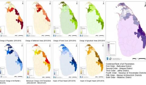
‘Early Identification of the drivers of environmental-resource-based communal conflicts for preventive action’ is a 12-month project that seeks to prevent conflict, by strengthening early warning and early response to environmental-resource-based conflicts that have the potential to deepen ethno-political fault lines and undermine social cohesion in the country. The project aims to identify the drivers of environmental resource-based conflicts through historical mapping of the issue focusing the dry zone and use GIS to conduct geo spatial mapping that will support the analysis of the above-mentioned issues and their trends and patterns.
In this regard, IUCN as the project consultant intends to develop geospatial mapping and analysis of resource-based conflicts in Northern and Eastern Provinces by directly working with the Technical Specialist-Reconciliation and Peacebuilding and the peacebuilding team on operational and implementation aspects of the intervention. The overall purpose is to collect the historical and current data on water and land-based conflicts/tensions in the dry zone, conduct systematic analysis of these conflicts, develop geographical heat maps that can be used as early warning for conflict prevention and management in the dry zone.
Objectives of the project
The objective of this consultancy assignment is to complete the following outputs:
- To assess and report the general context and dynamics of land and water resource-based issues and how they affect conflict and stability in the region
- To identify the stakeholders involved within the land and water resource-based issues in the dry zone, their roles and responsibilities and impact to conflict and stability in the dry zone
- To provide systematic historical and geo spatial mapping and analysis of resource-based conflicts in the dry zone
- To develop geographic heat maps using GIS combining both historical and current data to understand trends and patterns of resource-based conflicts in the dry zone.
Expected Outputs
- Submission of a detailed work plan for the assignment period with proposed dates and timelines
- Submission of an inception report outlining the process and methodology adopted for the intervention
- Develop an archival database on historical and current trends and patterns of resource-based conflicts in the dry zone
- Produce bi-monthly risk assessment reports on water and land-based conflicts/tensions in the dry zone
- Create a geographic heat map based on long and short-term historical data on climate events affecting the dry zone of Sri Lanka. This will also include reviewing of archival data such as the PIAC database on mapping civil war HR violations and how these correlates with land disputes
- Support establishing a Community of Practice (CoP) on climate change and human security where knowledge generated through the assignment will be shared and discussed to identify effective responses at local, regional, and national levels
- Submission of the final report
Donor/s: UNDP

