
Basic Page
Basic Page
Published on
2022 Jun 24Protected Area
Sri Lanka’s heritage of wildlife protection runs as far back as 2200 years. The first (fauna & flora) wildlife sanctuary in world at Mihintale, 12 km east of UNESCO World heritage Site of Anuradhapura was created by the King Devanampiya Tissa (307-266 BC), following the arrival of Buddhism to the island from northern India. With the establishment of Buddhism in ancient Sri Lanka in 250 BC, it became a Royal prerogative to carry out everything humanly possible to spread the doctrine throughout the island. Thereafter, throughout the history of the nation, all animals & plants in the wildlife sanctuaries of the island were left undisturbed in line with the basic right to life of all beings & conservation ethics of Buddhism, the taking of life being anathema to Buddhist beliefs. Renewal of laws giving protection to animals had been renewed and reinforced time and again by the kings of ancient Sri Lanka. Records of the wildlife protection are found in the great Sinhalese chronicle of Mahawamsa. A fine example is a twelfth century edict of King Nissanka Malla “ordering by beat of drum that no animal should be killed within a radius of 7 leagues of the city of Anuardhapura, he gave security to animals; he gave security to the fish in the 12 great tanks… and he also gave security to birds.” Those were the wild life sanctuaries of the old.
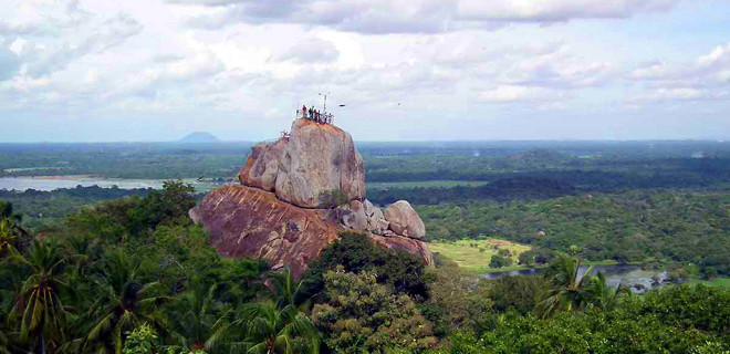
Protected areas of Sri Lanka are administrated by Department of Forest Conservation and Department of Wildlife Conservation of Sri Lanka. There are 501 protected areas in Sri Lanka. The protected areas falls under supervision Department of Forest Conservation include forests defined in National Heritage Wilderness Area Act in 1988, forest reservations and forests manage for sustainability. World heritage site, Sinharaja Forest Reserve is an example for a National Heritage forest. There are 32 forests categorized as conservation forests including Knuckles Mountain Range. Strict nature reserves, national parks, nature reserves, forest corridors and sanctuaries recognized under the Flora and Fauna Protection Ordinance are managed by Department of Wildlife Conservation. Total of all categories of areas protected is 1,767,000 ha. Protected areas in Sri Lanka accounts for 26.5 percent of total area. This is a higher percentage of protected areas than in all of Asia and much of the World.
Depending on their objectives National protected areas are classified into mainly six types. The first four categories of protected areas cover all the ecological and regions of Sri Lanka. The 5, 6, 7 categories were introduced in 1993 by amending the Flora and Fauna Protection Ordinance. However there are no regions declared under these categories so far.
- Strict nature reserves
- National parks
- Nature reserves
- Jungle corridors
- Refuge
- Marine reserves
- Buffer zones
- Sanctuaries
Strict Nature Reserves
Human activities are restricted in SNRs and they are protected as a pure natural system. Researches are allowed under the supervision of the Department of Wildlife Conservation staff and with the prior approval of the director.
| Protected area | Area in ha | Date of declaration |
|---|---|---|
| Hakgala | 1,141.60 | February 5, 1938 |
| Ritigala | 1,528.10 | November 7, 1941 |
| Yala | 28,904.70 | March 10, 1939 |
Showing 1 to 3 of 3 entries
National parks
National parks are areas allowed for the public to see and study wildlife. However necessary rules and regulations are introduced to protect wildlife and their habitats. The following are national parks in Sri Lanka administered by the Department of Wildlife Conservation.
| Name | Location | Area | Date of established |
|---|---|---|---|
| Yala | Southern Province and Uva | 978.807 km2 | February 25, 1938 |
| Wilpattu | North Central Province and North Western Province | 1,316.671 km2 | February 25, 1938 |
| Gal Oya | Uva and Eastern Province | 259 km2 | December 2, 1954 |
| Kumana | Eastern Province | 181.482 km2 | January 20, 1970 |
| Udawalawe | Sabaragamuwa and Uva Provinces | 308.21 km2 | June 30, 1972 |
| Lahugala Kitulana | Eastern Province | 15.54 km2 | October 31, 1980 |
| Maduru Oya | Eastern Province and Uva Province | 588.496 km2 | September 11, 1983 |
| Wasgamuwa | Central Province and North Central Province | 370.629 km2 | July 8, 1984 |
| Flood Plains | North Central Province | 173.50 km2 | July 8, 1984 |
| Somawathiya | North Central Province and Eastern Province | 396.455 km2 | February 9, 1986 |
| Horton Plains | Central Province | 31.598 km2 | March 16, 1988 |
| Bundala | Southern Province | 62.16 km2 | April 1, 1993 |
| Lunugamvehera | Uva and Southern Province | 234.988 km2 | August 12, 1995 |
| Minneriya | North Central Province | 88.894 km2 | December 8, 1997 |
| Kaudulla | North Central Province | 69 km2 | January 4, 2002 |
| Hikkaduwa | Southern Province | 1.016 km2 | August 10, 2002 |
| Pigeon Island | Eastern Province | 4.714 km2 | June 24, 2003 |
| Horagolla | Western Province | 0.133 km2 | June 24, 2004 |
| Galway's Land | Central Province | 0.267 km2 | May 18, 2006 |
| Angammedilla | North Central Province | 75.289 km2 | June 6, 2006 |
| Ussangoda | Southern Province | 3.49 km2 | June 1, 2010 |
| Mullaitivu National Park | Northern Province | December 1, 2010 |
Showing 1 to 22 of 22 entries
Nature reserves
Wildlife viewing and studying is restricted in these areas. Similar to Strict nature reserves scientific research is encouraged under the supervision of Department of Wildlife Conservation staff. These areas differ from strict nature reserves by allowing traditional human activities to continue.
| Protected area | Area in ha | Date of declaration |
|---|---|---|
| Triconamadu | 25,019.30 | October 24, 1986 |
| Riverine | 824.1 | July 31, 1991 |
| Minneriya-Girithale | ||
| Block II | 1,923.60 | June 25, 1993 |
| Block III | 4,745.30 | July 7, 1995 |
| Block IV | 8,335.50 | September 1, 1997 |
| Wetahirakanda | 3,229 | June 7, 2002 |
Showing 1 to 7 of 7 entries
Jungle corridors
A habitat corridor, wildlife corridor or green corridor is an area of habitat connecting wildlife populations separated by human activities or structures (such as roads, development, or logging). This allows an exchange of individuals between populations, which may help prevent the negative effects of inbreeding and reduced genetic diversity (via genetic drift) that often occur within isolated populations. Corridors may also help facilitate the re-establishment of populations that have been reduced or eliminated due to random events (such as fires or disease).
This may potentially moderate some of the worst effects of habitat fragmentation, wherein urbanization can split up habitat areas, causing animals to lose both their natural habitat and the ability to move between regions to use all of the resources they need to survive. Habitat fragmentation due to human development is an ever-increasing threat to biodiversity, and habitat corridors are a possible mitigation.
The only jungle corridor declared under the accelerated Mahaweli Programme.
Sanctuaries
Sanctuaries ensure the protection of wildlife of private lands which outside the state claim. In the sanctuaries protection of habitat and allowing of human activities occur simultaneously. Permission is not required for entry to these lands.
| Protected area | Area in ha | Date of declaration |
|---|---|---|
| Chundikulam | 11,149.10 | February 25, 1938 |
| Wilpattu North | 632 | February 25, 1938 |
| Telwatta | 1,424.50 | February 25, 1938 |
| Weerawila-Tissa | 4,164.20 | May 27, 1938 |
| Katagamuwa | 1,003.60 | May 27, 1938 |
| Polonnaruwa | 1,521.60 | May 27, 1938 |
| Tangamale | 131.5 | May 27, 1938 |
| Mihintale | 999.6 | May 27, 1938 |
| Kataragama | 837.7 | May 27, 1938 |
| Anuradhapura | 3,500.50 | May 27, 1938 |
| Udawatta Kele Sanctuary | 104 | July 29, 1938 |
| Rocky Islets | 1.2 | October 25, 1940 |
| Peak Wilderness Sanctuary | 22,379.10 | October 25, 1940 |
| Kurulu Kele (Kegalle) | 113.3 | March 14, 1941 |
| Pallemalala | 13.7 | October 23, 1942 |
| Welhilla Kategilla | 134.3 | February 18, 1949 |
| Kokkilai | 1,995 | May 18, 1951 |
| Senanayake Samudra | 9,324 | February 12, 1954 |
| Gal Oya North-East | 12,432 | February 12, 1954 |
| Gal Oya South-East | 15,281 | February 12, 1954 |
| Giant's Tank | 4,330.10 | September 24, 1954 |
| Vavunikulam | 4,856.20 | June 21, 1963 |
| Sakamam | 616.4 | June 21, 1963 |
| Padawiya Tank | 6,475 | June 21, 1963 |
| Naval Headworks Sanctuary | 18,130 | June 21, 1963 |
| Great Sober Island | 64.7 | June 21, 1963 |
| Little Sober Island | 6.5 | June 21, 1963 |
| Kimbulwana Oya | 492.1 | June 21, 1963 |
| Mahakanadarawa Wewa | 519.3 | December 9, 1966 |
| Madhu Road | 26,677 | June 28, 1968 |
| Seruwila-Allai | 15,540 | October 9, 1970 |
| Paretitivu Island | 97.1 | May 18, 1973 |
| Honduwa Island | 8.5 | November 19, 1973 |
| Buddhangala | 1,841.30 | November 1, 1974 |
| Ravana Falls | 1,932 | May 18, 1979 |
| Medinduwa | 0.8 | June 6, 1980 |
| Kalametiya lagoon | 2,525.20 | November 1, 1984 |
| Sri Jayawardenapura birds sanctuary | 449.2 | January 9, 1985 |
| Victoria-Randenigala-Rantembe | 42,087.30 | January 30, 1987 |
| Maimbulkanda - Nittambuwa | 25.1 | June 8, 1988 |
| Parapuduwa Nuns' Island | 189.6 | August 17, 1988 |
| Kahalla-Pallekele | 21,690 | July 1, 1989 |
| Sigiriya | 5,099 | January 26, 1990 |
| Bellanwila-Attidiya | 372 | July 25, 1990 |
| Bar Reef | 30,669.90 | April 3, 1992 |
| Nimalawa | 1,065.80 | February 18, 1993 |
| Madunagala | 995.2 | June 30, 1993 |
| Muthurajawela block I | 1,028.60 | October 31, 1996 |
| Muthurajawela block II | 256.8 | October 31, 1996 |
| Anawilundawa | 1,397 | June 11, 1997 |
| Elahera-Girithale | 14,035.20 | January 13, 2000 |
| Dahaiyagala | 2,685.10 | June 7, 2002 |
| Tabbowa | 2,193.30 | July 19, 2002 |
| Rumassala | 170.7 | January 3, 2003 |
| Kiralakele | 310 | September 8, 2003 |
| Eluwiliyaya | 186 | September 11, 2009 |
| Kaudulla-Minneriya | 8,777.30 | June 1, 2004 |
| Kirama | 45.7 | October 6, 2004 |
| Kudumbigala | 6,533.90 | February 20, 2006 |
| Rekawa | - | May 25, 2006 |
| Godawaya | - | May 25, 2006 |
| Bundala - Wilmanna | 3,339.40 | June 30, 2006 |
| Maduganga | 2,300 | July 17, 2006 |
| Bogahapitiya (proposed) |
Showing 1 to 64 of 64 entries